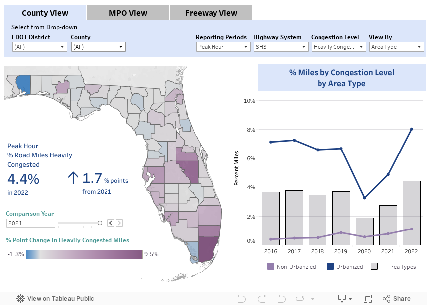
% Miles by Congestion Level
Updated Using 2022 Data
This measure reports the percent of roadway miles categorized as heavily congested, mildly congested, or uncongested. Each congestion category is classified based on average travel speeds that meet the corresponding congestion thresholds.
Date of last refresh: 10/19/2023
SOURCES
FDOT - Traffic Characteristics Inventory
FDOT - Roadway Characteristics Inventory Feature 147 (Strategic Intermodal System) and Feature 311 (Speed Limits)
HERE Technologies - Travel Time Data